
The first row is for desktop, and second row is for Tab and Mobile.
You can right click on this text and use Navigator for easy editing. This text message is hidden on all screens using Advanced/responsive tab on left.
The Dubai Metro Green Line is an integral part of Dubai’s advanced public transportation system, serving as a vital artery connecting key areas of the city. As we delve into the intricacies of the green line metro map dubai, we’ll explore its stations, routes, and significance in the larger context of Dubai’s urban mobility landscape.


Since its inception, the Green Line Metro has transformed the way residents and visitors navigate Dubai. Opened in September 2011, this line has become an essential component of the city’s infrastructure, complementing the existing Red Line and creating a more comprehensive metro network.
To fully appreciate the Green Line Metro Map, it’s crucial to understand the concept of zones in Dubai’s metro system. The Dubai Metro zones are designed to streamline fare calculation and optimize travel efficiency across the city.
The Dubai Metro zone map divides the city into several zones, with the Green Line traversing multiple zones. This zoning system allows for a fair and transparent fare structure, ensuring that passengers pay based on the distance traveled.
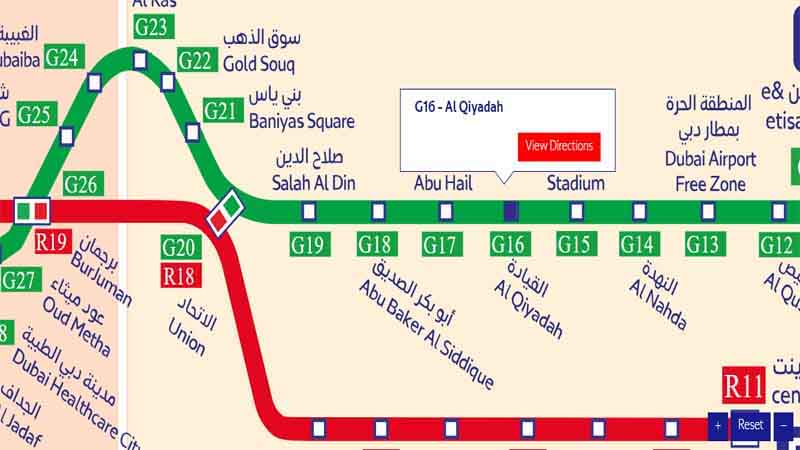
The Green Line Metro Dubai boasts an impressive array of stations, each serving as a gateway to different neighborhoods and attractions. Let’s explore some of the key stations along this route.
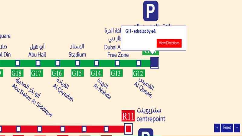
The Etisalat Metro Station serves as the northern terminus of the Green Line. This station is a crucial hub for commuters traveling to and from the Al Qusais area.
Located in the heart of Dubai, the Abu Hail Metro Station is a vital connection point for residents and visitors alike. Its strategic position makes it an essential stop for those exploring the city’s diverse offerings.
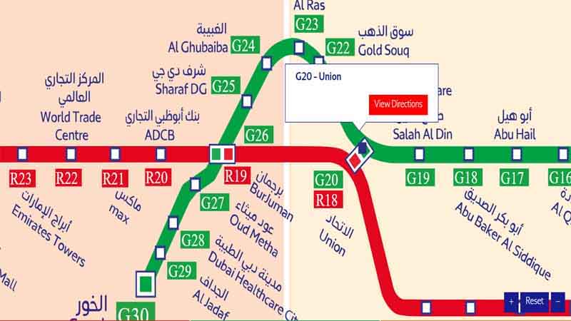
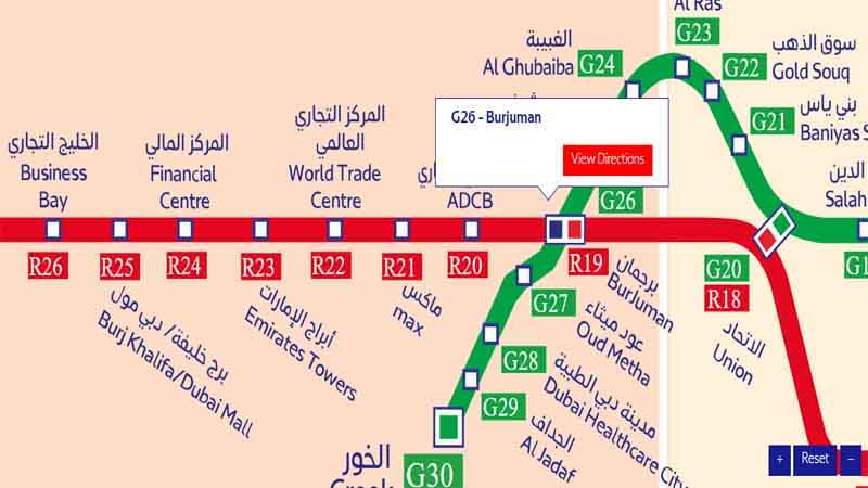
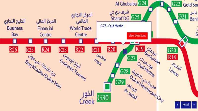
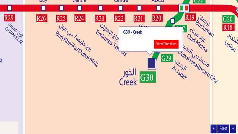
The Oud Metha Metro Station is another significant stop along the Green Line, providing access to numerous educational institutions and healthcare facilities in the area.
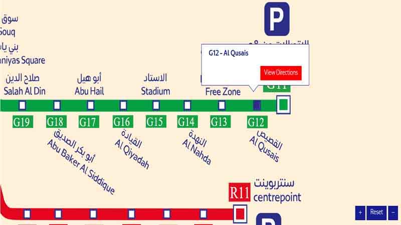
Situated in one of Dubai’s most populous residential areas, the Al Qusais Metro Station plays a crucial role in connecting residents to the rest of the city.
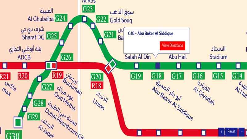
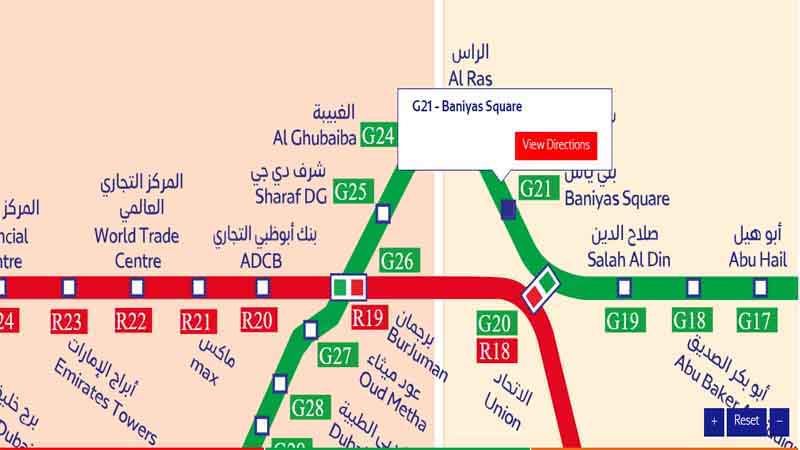
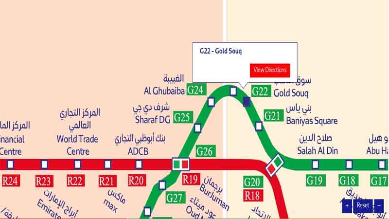
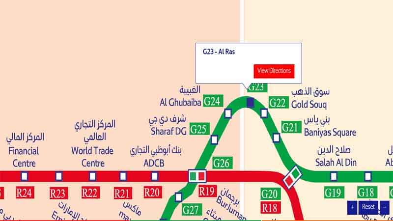
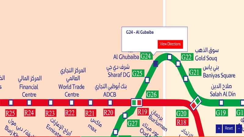
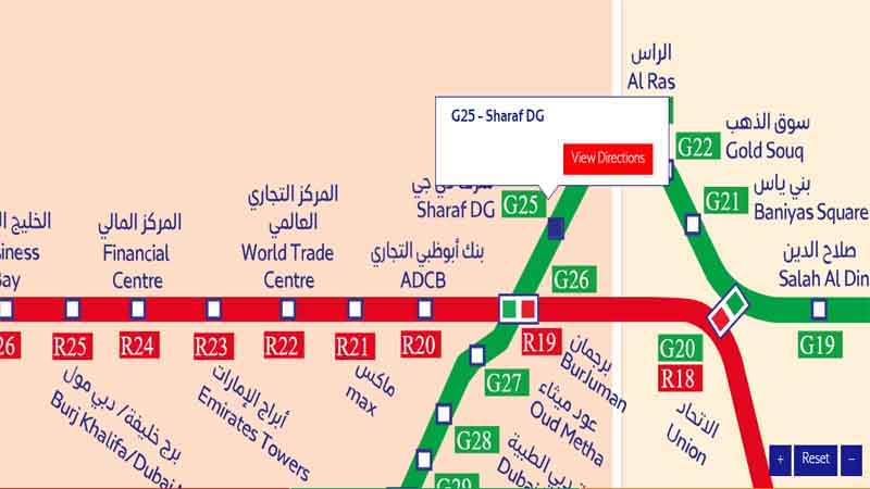
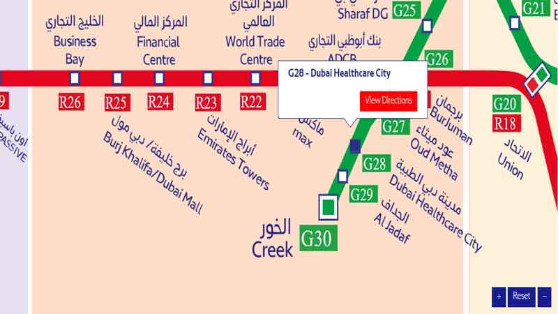
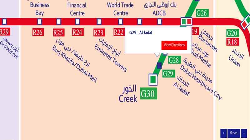
Understanding the layout and sequence of stations along the Green Line is essential for efficient travel. Let’s take a closer look at the Dubai Metro Green Line stations list.
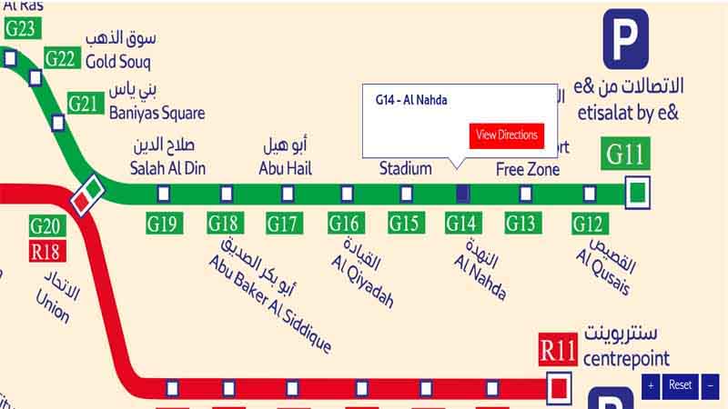
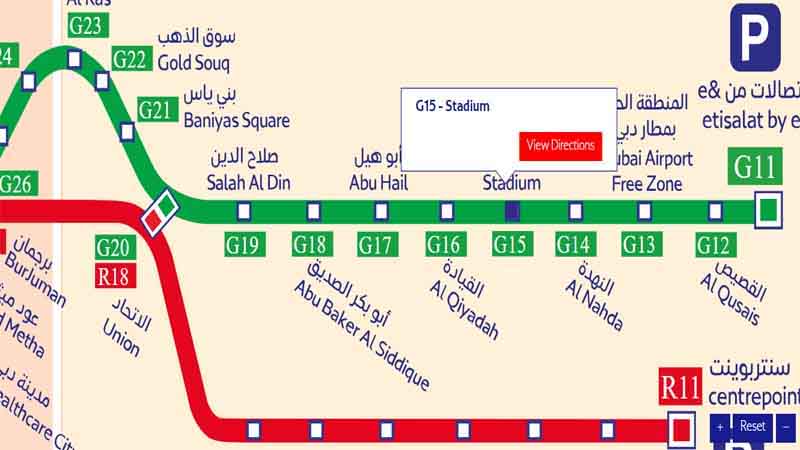
The Green Line features 20 stations, each uniquely designed to reflect Dubai’s modern architectural aesthetics while providing optimal functionality for passengers.
Some of the most notable stations along the Green Line include:
While our focus is on the Green Line, it’s important to consider its place within the larger UAE Metro map. Dubai’s metro system is a pioneering project in the UAE, setting the standard for urban rail transit in the region.
The Metro Dubai map illustrates how the Green Line integrates with other metro lines and transportation options, creating a seamless network for urban mobility.
As we examine the Dubai Metro map 2023, it’s evident that the system continues to evolve and expand. The Green Line, in particular, has seen enhancements to better serve the growing population and changing urban landscape.
Recent years have seen the addition of new stations and the optimization of existing routes along the Green Line, further improving its efficiency and reach.
For both residents and tourists, the Green Line Metro map Dubai is an invaluable tool for planning trips across the city. Let’s explore how to make the most of this comprehensive map.
The map uses clear symbols to denote different types of stations, including terminuses, interchanges, and regular stops. Familiarizing yourself with these symbols can greatly enhance your navigation experience.
Many stations along the Green Line are strategically located near important landmarks, making it easier for passengers to orient themselves and plan their excursions.
To answer this frequently asked question, let’s provide a comprehensive list of all stations along the Green Line:
To make the most of your journeys on the Green Line, consider the following tips:
As Dubai continues to grow and evolve, so too does its metro system. The Green Line is expected to see further expansions and enhancements in the coming years, solidifying its role as a crucial component of Dubai’s urban infrastructure.
While specific plans may vary, discussions about extending the Green Line to serve new developments and communities are ongoing. These potential expansions could further improve connectivity and accessibility across Dubai.
To address common queries about the Green Line, here are some frequently asked questions:
The Dubai Metro Green Line Map is more than just a navigational tool; it’s a gateway to exploring the diverse and vibrant city of Dubai. From the bustling streets of Deira to the modern healthcare facilities in Dubai Healthcare City, the Green Line connects passengers to a myriad of experiences and opportunities.
As we’ve explored in this comprehensive guide, understanding the intricacies of the Green Line – from its station layouts to its integration with the broader Dubai metro system – can significantly enhance your travel experience in the city. Whether you’re a resident commuting daily or a tourist eager to explore Dubai’s attractions, the Green Line offers a reliable, efficient, and comfortable mode of transportation.
Remember to stay updated with the latest Dubai Metro map 2023 changes and expansions, as the system continues to evolve to meet the needs of the city’s growing population and visitor numbers. By mastering the Green Line Metro map Dubai, you’re not just learning about a transportation route; you’re unlocking the key to navigating one of the world’s most dynamic and exciting cities.
So, the next time you’re planning a trip across Dubai, consider the Green Line as your preferred mode of transport. With its extensive coverage, frequent service, and strategic station locations, it’s sure to get you where you need to go – efficiently, comfortably, and with the added bonus of experiencing Dubai’s cutting-edge public transportation system.
Embrace the Green Line Metro Dubai, and let it be your guide to discovering all that this remarkable city has to offer. Whether you’re heading to work, exploring tourist attractions, or simply enjoying a day out in the city, the Green Line is your reliable companion in navigating the urban landscape of Dubai. Happy travels on the Green Line Metro! lin